🚚 Free Worldwide Shipping on All Orders!Shop Now
World in Maps (Collins Primary Atlases)**
Pages: 56,
Specialty: Children,
Publisher: HarperCollins,
Publication Year: 2014,
Cover: Paperback,
Dimensions: 220x308x10mm
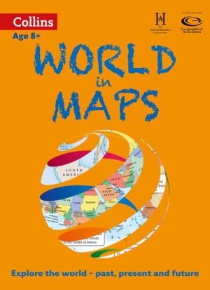
Collins World in Maps is a multi-topic atlas of the world, which introduces the most relevant physical and human topics to reflect the Geography Key Stage 2-3 requirements of the National Curriculum. Formerly published as Collins Keystart World Atlas, this collection of maps can be used to investigate different themes and topics. It tells a story in maps, diagrams, charts, words and photographs, each of which presents information to compare and examine. We live on a remarkable planet and this atlas helps us to make sense of the world today and understand how things came to be, as well as how they might change in years to come. Suggested activities on each spread encourage users to explorer further.show more
Specialty: Children,
Publisher: HarperCollins,
Publication Year: 2014,
Cover: Paperback,
Dimensions: 220x308x10mm
Collins World in Maps is a multi-topic atlas of the world, which introduces the most relevant physical and human topics to reflect the Geography Key Stage 2-3 requirements of the National Curriculum. Formerly published as Collins Keystart World Atlas, this collection of maps can be used to investigate different themes and topics. It tells a story in maps, diagrams, charts, words and photographs, each of which presents information to compare and examine. We live on a remarkable planet and this atlas helps us to make sense of the world today and understand how things came to be, as well as how they might change in years to come. Suggested activities on each spread encourage users to explorer further.show more
Pages: 56,
Specialty: Children,
Publisher: HarperCollins,
Publication Year: 2014,
Cover: Paperback,
Dimensions: 220x308x10mm
Collins World in Maps is a multi-topic atlas of the world, which introduces the most relevant physical and human topics to reflect the Geography Key Stage 2-3 requirements of the National Curriculum. Formerly published as Collins Keystart World Atlas, this collection of maps can be used to investigate different themes and topics. It tells a story in maps, diagrams, charts, words and photographs, each of which presents information to compare and examine. We live on a remarkable planet and this atlas helps us to make sense of the world today and understand how things came to be, as well as how they might change in years to come. Suggested activities on each spread encourage users to explorer further.show more
Specialty: Children,
Publisher: HarperCollins,
Publication Year: 2014,
Cover: Paperback,
Dimensions: 220x308x10mm
Collins World in Maps is a multi-topic atlas of the world, which introduces the most relevant physical and human topics to reflect the Geography Key Stage 2-3 requirements of the National Curriculum. Formerly published as Collins Keystart World Atlas, this collection of maps can be used to investigate different themes and topics. It tells a story in maps, diagrams, charts, words and photographs, each of which presents information to compare and examine. We live on a remarkable planet and this atlas helps us to make sense of the world today and understand how things came to be, as well as how they might change in years to come. Suggested activities on each spread encourage users to explorer further.show more
$4.20
Original: $12.00
-65%World in Maps (Collins Primary Atlases)**—
$12.00
$4.20Description
Pages: 56,
Specialty: Children,
Publisher: HarperCollins,
Publication Year: 2014,
Cover: Paperback,
Dimensions: 220x308x10mm
Collins World in Maps is a multi-topic atlas of the world, which introduces the most relevant physical and human topics to reflect the Geography Key Stage 2-3 requirements of the National Curriculum. Formerly published as Collins Keystart World Atlas, this collection of maps can be used to investigate different themes and topics. It tells a story in maps, diagrams, charts, words and photographs, each of which presents information to compare and examine. We live on a remarkable planet and this atlas helps us to make sense of the world today and understand how things came to be, as well as how they might change in years to come. Suggested activities on each spread encourage users to explorer further.show more
Specialty: Children,
Publisher: HarperCollins,
Publication Year: 2014,
Cover: Paperback,
Dimensions: 220x308x10mm
Collins World in Maps is a multi-topic atlas of the world, which introduces the most relevant physical and human topics to reflect the Geography Key Stage 2-3 requirements of the National Curriculum. Formerly published as Collins Keystart World Atlas, this collection of maps can be used to investigate different themes and topics. It tells a story in maps, diagrams, charts, words and photographs, each of which presents information to compare and examine. We live on a remarkable planet and this atlas helps us to make sense of the world today and understand how things came to be, as well as how they might change in years to come. Suggested activities on each spread encourage users to explorer further.show more